
 Français
 Español
 Deutsch
 Italiano
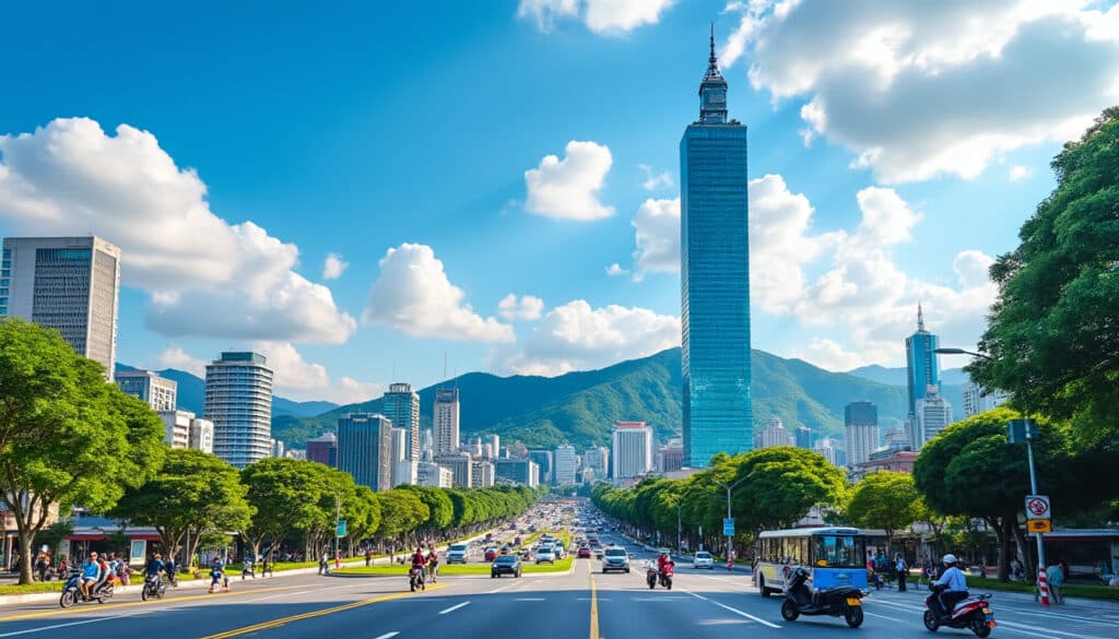
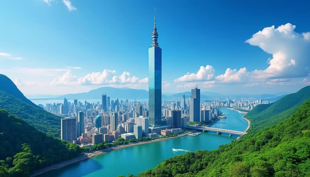
Taipei is renowned for its vibrant culture, bustling night markets, and impressive skyline, particularly highlighted by the towering Taipei 101. However, the city’s geographical elevation also plays an integral role in shaping its unique environment and urban landscape. As the capital city of Taiwan, Taipei sits within the Taipei Basin, a key feature that contributes to its distinctive topographical character. Understanding the elevation of Taipei adds depth to the city’s geographical narrative.
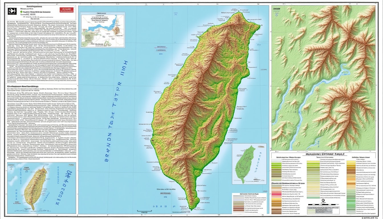
Elevation Map & Topography of Taiwan
Taiwan’s topography is a study in contrasts, with towering mountain ranges juxtaposed against coastal plains. The island is predominantly mountainous, covering approximately two-thirds of the land area. The Central Mountain Range runs vertically through Taiwan, creating a natural spine that influences the island’s climate and biodiversity. In fact, Taiwan boasts more than 100 peaks over 3,000 meters, making it a paradise for hikers and nature enthusiasts.
Overall, Taiwan’s topography shapes not just its weather patterns but also its natural resources and biodiversity. The elevation changes throughout the island create various climates and ecosystems, ranging from tropical southern regions to temperate highlands. These variations make Taiwan an intriguing destination for both environmental study and outdoor exploration.
Mapping the elevation provides insight into the island’s natural formations and how these have influenced settlement and infrastructure development. For instance, the Western Plain, which includes Taipei, is home to the majority of Taiwan’s population and is critical to its economic activities and urban development. The juxtaposition of towering peaks and lowland areas enriches the island’s cultural and ecological narrative.
Within this topographical spectrum, Taipei typically stands out due to its distinctive position in the Taipei Basin. This basin is a low-lying area, shaped by the confluence of several rivers, and surrounded by mountain ranges. The Taipei Basin is not only a geographic centerpiece but also a historical one, as its fertile lands have long supported human habitation and city development.
Taipei’s Low Luster: The City in the Clouds
One might wonder why Taipei, despite being known for its contemporary skyline, is primarily characterized by its relatively low elevation. Most of Taipei is approximately 10 meters (about 33 feet) above sea level, forming a low-center point in the broader mountainous terrain of Taiwan. The city’s low elevation emphasizes its basin origin, which historically provided a fertile site for urban development.
The geographical low point is central to the city’s urban development. The rivers that meander through the basin, including the Keelung River and the Tamsui River, have historically dictated settlement patterns and continue to influence urban planning and disaster management strategies, particularly in relation to flood control.
This low elevation area supports a significant portion of Taipei’s population and infrastructural framework. The relatively flat lowlands facilitated the extensive development of transportation networks such as the Taiwan High Speed Rail and key roadways that link the city with other parts of the island.
An interesting aspect of the elevation is its impact on the local climate. Taipei experiences a humid subtropical climate with hot summers and foggy winters, conditions influenced by the pooling of cool air within the basin. The elevation and geographic setting thus contribute directly to the quality of air and the prevalence of specific weather patterns like typhoons and monsoons.
To visualize Taipei’s topography, maps that indicate elevation through color gradients are beneficial. These maps highlight not only the basin’s floor but also the surrounding mountainous regions, such as Yangmingshan National Park to the north. This park includes Qixing Mountain, the highest point in the city, which stands at 1,120 meters (3,670 feet) above sea level, offering a stark contrast to the city’s lower elevation areas.
Impact of Elevation on Taipei’s Climate and Urban Life
The elevation of Taipei, nesting low in the Taipei Basin, has a notable effect on its climate. This elevation creates a microclimate in the city vastly different from the elevated regions in Northern Taiwan. Taipei’s basin location means a humid subtropical climate prevails, characterized by long, hot summers and short, mild winters that are frequently foggy.
Positioned within the basin, the city often experiences a pooling effect of the cooler Siberian winds, especially during the winter months, leading to increased fog and reduced sunshine. This phenomenon is less prevalent in elevated areas like Yangmingshan, which features cooler and clearer weather conditions.
Urban life in Taipei is shaped significantly by these climatic conditions. For instance, the architecture often incorporates features to address the high humidity, such as ventilated designs and moisture-resistant building materials. Similarly, Taipei’s urban design has been shaped by the need to manage the significant rainfall that affects the basin annually.
The elevation also influences social dynamics in Taipei. The contrast between the low-lying city and the rapidly rising suburbs in mountainous regions reflects diverse residential and recreational patterns. Mountains like Yangmingshan serve as retreats for leisure and offer panoramic views of the sprawling city below, playing a role in urban leisure and tourism dynamics.
The basin’s elevation also affects infrastructure resilience. Flooding is a potential risk due to the low elevation and the convergence of rivers, leading to substantial investments in urban planning projects such as flood control systems and green infrastructure. These have become integral to maintaining Taipei’s status as a leading global city.
Cultural and Societal Implications of Taipei’s Elevation
Elevation doesn’t just dictate Taipei’s physical attributes; it has ripple effects on its cultural and societal structures. For instance, the low-lying areas have been centers of trade and economic activity due to their accessibility. Historically, this geographical feature facilitated trade through port towns, underpinning Taipei’s growth as a commercial hub.
The city’s elevation and basin shape have contributed to a transportation network adept at handling Taipei’s dense population. The flat terrains have supported the building of extensive roadways and rail systems like the Taiwan High Speed Rail, which connects industrial and residential domains seamlessly.
The cultural dynamics can also be traced to Taipei’s geographical dichotomy. The mountains surrounding the basin have long been associated with spiritual and cultural significance. Places like Yangmingshan offer cultural festivals and outdoor activities, fostering a blend of urban and natural life intrinsic to the Taipei ethos.
Moreover, the basin’s geography has shaped the development of Taipei’s neighborhoods, concentrating populations into distinct districts that vary in density and character. Districts like Daan and Ximending highlight the vibrant urban life, while nearby Yangmingshan provides a quieter, nature-oriented contrast.
Additionally, the geographical elevation contributes to the distinct culinary scene in Taipei. Proximity to the flatlands allows fresh produce to thrive, feeding into the vibrant food culture celebrated in Taipei’s many night markets, such as Shilin Night Market.
Technical Insights: Taipei’s Elevation in Urban Planning
The geographical elevation of Taipei plays a crucial role in its urban planning and development strategies. The city’s low elevation necessitates comprehensive water management systems, crucial for preventing flooding in the densely populated basin.
Strategies such as the building of dikes and the implementation of sophisticated drainage systems have been pivotal in safeguarding Taipei from seasonal weather impacts. The city’s planners continuously work on enhancing these systems to adapt to the challenges posed by rising sea levels and increased rainfall attributable to climate change.
Furthermore, Taipei’s urban planning must account for its elevation when it comes to infrastructure and public services. The establishment of the Taipei Metro and efficient road networks like highways and main arteries were strategically planned to compensate for the city’s elevation-related threats.
In terms of development, Taipei has invested in green infrastructure to manage its elevation’s impact on urban flooding. Parks like Daan Forest Park and water-efficient green spaces integrate into the city’s landscape, offering an ecological respite and enhancing urban biodiversity.
The elevation’s role extends to construction norms as well, where building designs incorporate flood-resistant features to enhance resilience against water-related incidents. Use of permeable materials and the provision of submersible basements are among the strategies deployed in Taipei’s urban construction.
Awareness of Taipei’s elevation continues to shape its identity as a global city, fostering a synergy between urban and natural environments and ensuring sustainable growth well into the future.
What is the average elevation of Taipei?
The average elevation of Taipei is around 10 meters (about 33 feet) above sea level, situated within the Taipei Basin.
How does Taipei’s elevation affect its climate?
Taipei’s low elevation in the basin contributes to its humid subtropical climate, characterized by hot summers and mild, foggy winters.
What are some natural features surrounding Taipei?
Surrounding Taipei are features like Yangmingshan National Park with its mountainous regions and Qixing Mountain, the highest peak in Taipei.
How does Taipei manage flooding?
Flood management in Taipei involves sophisticated drainage systems, dikes, and the development of green infrastructure to mitigate seasonal floods.
What role does elevation play in Taipei’s urban planning?
Elevation influences Taipei’s urban planning, especially in water management, infrastructure resilience, and sustainable development initiatives.
Where is Taipei on the map of the world?
Discovering Taipei: A Geographical Overview Taipei, the capital city of Taiwan, is strategically nestled in the northern part of the island. Located in the Taipei Basin, the city enjoys a remarkable backdrop of lush mountains, making it one of East…
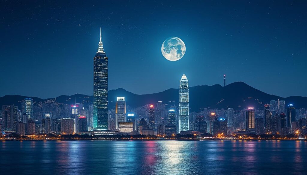
Does the moonlight shine on Taipei?
The Enchanting Moonlight Over Taipei’s Skyline The moonlight playing over the expansive skyline of Taipei offers a spectacular view, captivating both residents and visitors. As the moon ascends, it casts an ethereal glow that transforms the bustling city into a…
The city of Taipei, located at the northern tip of Taiwan, serves as both the capital and largest city of this vibrant island nation. 🇹🇼 Often referred to by its historical name, Formosa, Taiwan boasts a rich cultural heritage and…